Aerial imagery provides a perspective that ground-level cameras simply cannot match. Whether you need to showcase a sprawling commercial property, monitor a construction site, or capture breathtaking establishing shots for a video production, we provide professional, safe, and legal aerial solutions.
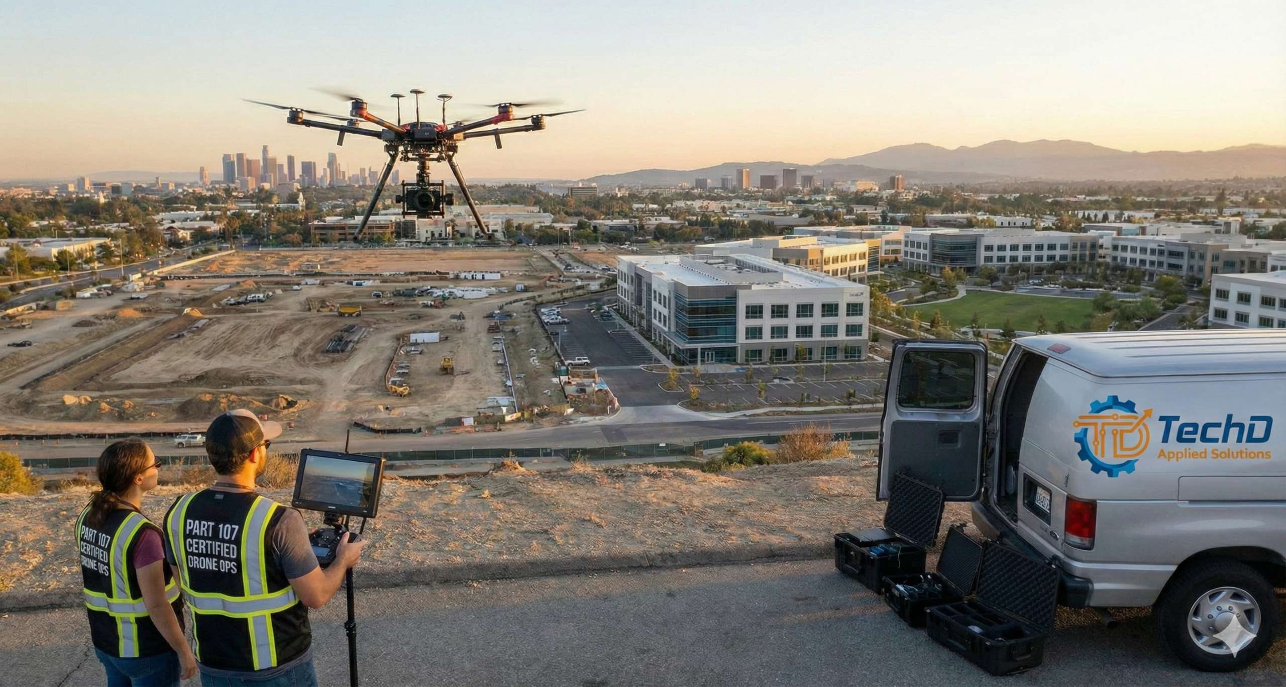
We operate strictly under FAA Part 107 regulations, ensuring that every flight is compliant with federal law, fully insured, and conducted with the highest safety standards.
🛡️ FAA Part 107 Certified & Insured
Hiring a non-certified drone operator for commercial work puts your business at legal risk. We take the complexity out of aerial operations so you can focus on the results.
- Licensed Pilots: All operations are conducted by Pilot in Command (PIC) holding a current FAA Remote Pilot Certificate.
- Airspace Authorization: We handle all pre-flight planning, including checking NOTAMs (Notices to Air Missions) and securing LAANC authorizations to fly in controlled airspace near airports when necessary.
- Liability Insurance: Every flight is covered by commercial aviation liability insurance for your peace of mind.
🏗️ Construction Progress & Site Monitoring
Keep stakeholders informed and document every stage of your build with periodic aerial updates.
- Progress Tracking: Scheduled weekly or monthly flyovers to document site changes and milestones.
- Asset Management: Get a bird’s-eye view of material staging, equipment location, and site logistics.
- Time-Lapse Potential: We capture consistent angles over long periods to create compelling start-to-finish project time-lapses.
🏢 Real Estate & Property Marketing
Still photos from the curb don’t tell the whole story. Aerial imaging captures the scale, location, and context of a property.
- Commercial Real Estate: Showcase proximity to highways, traffic flow, and neighboring anchors to attract investors and tenants.
- Residential Listings: Highlight lot size, landscaping, and neighborhood amenities for high-end residential sales.
- Land Development: Provide clear overhead views of property lines, terrain, and access points for raw land sales.
🔍 Infrastructure & Roof Inspections
Reduce risk and liability by keeping your team on the ground. Our drones can access hard-to-reach areas quickly and safely.
- High-Resolution Inspection: Capture 4K video and high-resolution stills of rooftops, HVAC units, towers, and facades to identify damage or wear.
- Preventative Maintenance: Spot potential issues—such as clogged gutters, loose shingles, or structural cracks—before they become costly repairs.
- Safety First: Eliminate the need for ladders, scaffolding, or lifts for preliminary assessments.
🎬 Aerial Cinematography for Video Production
Enhance your marketing videos with high-production-value shots that grab attention immediately.
- Establishing Shots: Set the scene with sweeping panoramic views of your facility or city skyline.
- Dynamic Motion: We utilize 3-axis gimbals and advanced flight maneuvers to create buttery-smooth, cinematic motion that integrates seamlessly with ground-level footage.
- Event Coverage: Capture the magnitude of outdoor events, festivals, and corporate retreats from a unique vantage point.
📦 Deliverables
We provide flexible delivery options to suit your workflow.
Data Integration: Geo-tagged images for mapping and photogrammetry applications (upon request).
Raw Assets: Unprocessed D-Log or high-bitrate footage for your internal editing team.
Edited Packages: Fully color-graded and edited clips ready for social media or web integration.
